FIRST ORIENTEERING MEET
In preparation for my first Adventure Race, I worked on developing my navigation skills through orienteering. I'm fortunate to have a number of permanent orienteering courses in my area. This would be my first meet, though. At a meet, there's a self-initiated staggered start for those who sign up, so that people aren't just conga line following each other from CP to CP. There are different course options to choose from, based on the level of difficulty that you want to tackle from a navigational perspective and physical perspective. There's a time limit for completing your route by finding all the CPs, and getting back to the start, so choose your course wisely when you sign up. SB, my co-navigator for Sea to Sea, had another event that she had committed to doing this morning, so I was going to tackle this on my own.
At the events put on by the Carolina Orienteering Klubb, you have 3 hours to complete your course. The faster you complete it, the higher your placement, within your course category. Points are pre-plotted on your map, and you must use your electronic punch to visit the points in the specified sequence, but you get to choose the route you take to get from one point to the next. You take into account terrain features, vegetation, the availability of trails, the use of attack points, the availability of handrails and backstops, etc. Your time doesn't start until you punch the start line reader with your finger stick, so you can pick up your map early to do route planning.

I picked up my map and got to planning. I figured out how I wanted to get from one point to another based on the factors listed above. I used my protractor to measure the bearings I'd have to take at different landmarks along the way. I used the map wheel to measure distances, so that I'd be able to do pace counts and see where I was along the way, compared to the expected distance between landmarks. Route planning is maybe the most fun part of the event. There's a lot of strategy involved. You figure out how you want to play to your strengths, take or manage risks, etc.

Eventually (maybe 45 minutes later), I decided that I was ready to set off, after one last trip to a real bathroom. I turned on Strava on my phone just so that I could see my actual route afterwards, and compare it to what I had intended to do. Of course, I wouldn't look at it or any other electronic navigational device during the event itself.
The organizers showed me how the electronic stick clearing, checking, and starting process worked (to clear out old data, verify that the stick works and has batteries, and then to trigger your start). Then, I was off!

I headed through the parking lot, and made my way downhill towards a creek. I saw a log that I could use to cross the creek, which I was excited about, because it meant that I wouldn't need to get my feet wet, at least not yet. I excitedly crossed it. Then, I looked back at the map and realized that the CP was on the other side of the creek that I had just crossed, so I had to cross right back, haha.
There were quite a few people around at this time, so somewhat following where others were, I found the first point. It was quite steep, so it took some climbing skills to get up and down. Too bad I made an extra trip up and down. I laughed at myself, though.


Time to find the next one! My plan was to follow a thin area between the creek and thick vegetation. I ran across a CP flag on a bridge. It was way too early to be the one that I was looking for. I didn't want to punch it if it wasn't mine, or mistakenly think that I got my second point if it wasn't my point. It later occurred to me that it was a point for a different course level. It's not that the other courses have a subset of the points that my course has... they sometimes have points that we don't have. It was probably a white course (easy course) point, since it was right on a bridge (a bridge which one could use instead of trying to carefully use a log). The bridge itself hadn't been on my map. Not all trails are necessarily mapped, since trail systems are constantly evolving, and these maps are expensive to lay out because of the amount of detail that they contain. Orienteering maps are among the most detailed out there, because they'll even plot rock piles, tree stumps, benches and other mand-made objects, etc. I'd later realize that each control point that I had was actully identified by a unique ID on my map, and that each electronic receiver on the CP was also labelled with a unique ID, so it's actually supposed to be easy to check if a given CP is one on your list.
Anyways, fortunately, before I realized all those things, I was able to make the right call to ignore that CP and continue to look for my second one. I walked further. There was another group near me, and also a woman who I'd occasionally see, but despite this being my first time, I trusted my own skills and just focused on what I was doing and didn't get swayed by what they were doing. A tip you'll sometimes hear is that if you think you've gone far enough, you probably haven't, and that was the case here, too. I found it!

I continued along that same general direction to find the third point. I was able to use the border of a thickly vegetated area to help me know where I was on the map.

As I mentioned earlier, there was a woman near me, and we both found it at about the same time, and we must've been on the same or similar courses, because we headed out in the same general direction to the next point, although my compass for my selected route had me left of hers by a little bit. She looked experienced, and was wearing what looked like an orienteering jersey, even. I still tried to do my own thing, and not let her choices sway me one way or another.
I looked for a power line crossing that I expected to hit, and then that gave me a secondary check on distance to the fourth point. I was actually like 75 yards off by the time I got to the fourth point... I was too far to the right. But there were a few people around, so I saw where it was when I got there. They found it first and left first and put some distance on, though, afterwards. I do want to be able to find these independently as much as possible.


I had a good intermediate landmark on my way to the next point... an asphalt road, and it would be impossible to miss, so I could move faster for the next portion and not have to worry about pace counting until I hit the road, as long as I was going in the right direction. There was a section of muddy ground that got my feet a little wet, but that was the only time.
I hit the road and crossed it. There was more walking to do. I didn't find the point at first. Then, I realized on the map that the point would be at the end of a creek bed. I had gone too far, so I backtracked a bit to where I saw a creek bed, and found it. I was proud of myself for course correcting using terrain features.


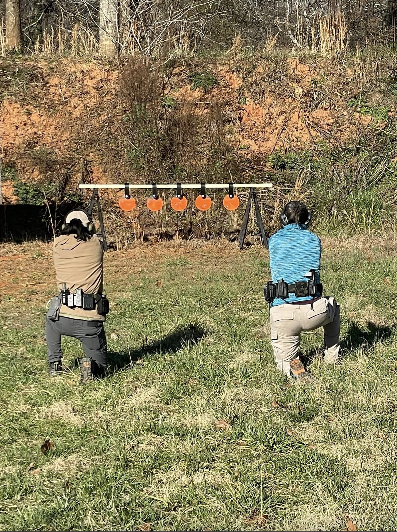
PEW PRACTICE
SB and I worked on pistol for an hour on steel, aiming for various targets down the line.
We did standing and kneeling.
We did some horizontal walking and shooting down the line.
We did singles, controlled pairs, and gradually increasing counts, from holster.

No comments:
Post a Comment