TRAINING LEAD-UP
Sunday, Feb 11:
I was still deciding what portions of the GORUCK Bragg HTB I'd be doing this year. The past 2 years, I did the TB, which was actually pretty nice. You get to go in to the Tough fresh and can be a boon to everyone that is tired from the Heavy. You still feel accomplished after doing the Basic, and you get to see everyone get their bolts at the end. The vibe at Bragg is different, too, and there are more post-event celebrations afterwards than you'd normally get.
I had about a week left before I had to decide whether to keep my Heavy registration or request a refund. I haven't been doing very much strength training, apart from body weight work. I haven't rucked a significant amount in the past couple of years, either. Body weight exercises will get you strong, but in a different way than sandbag work or even ruck PT.
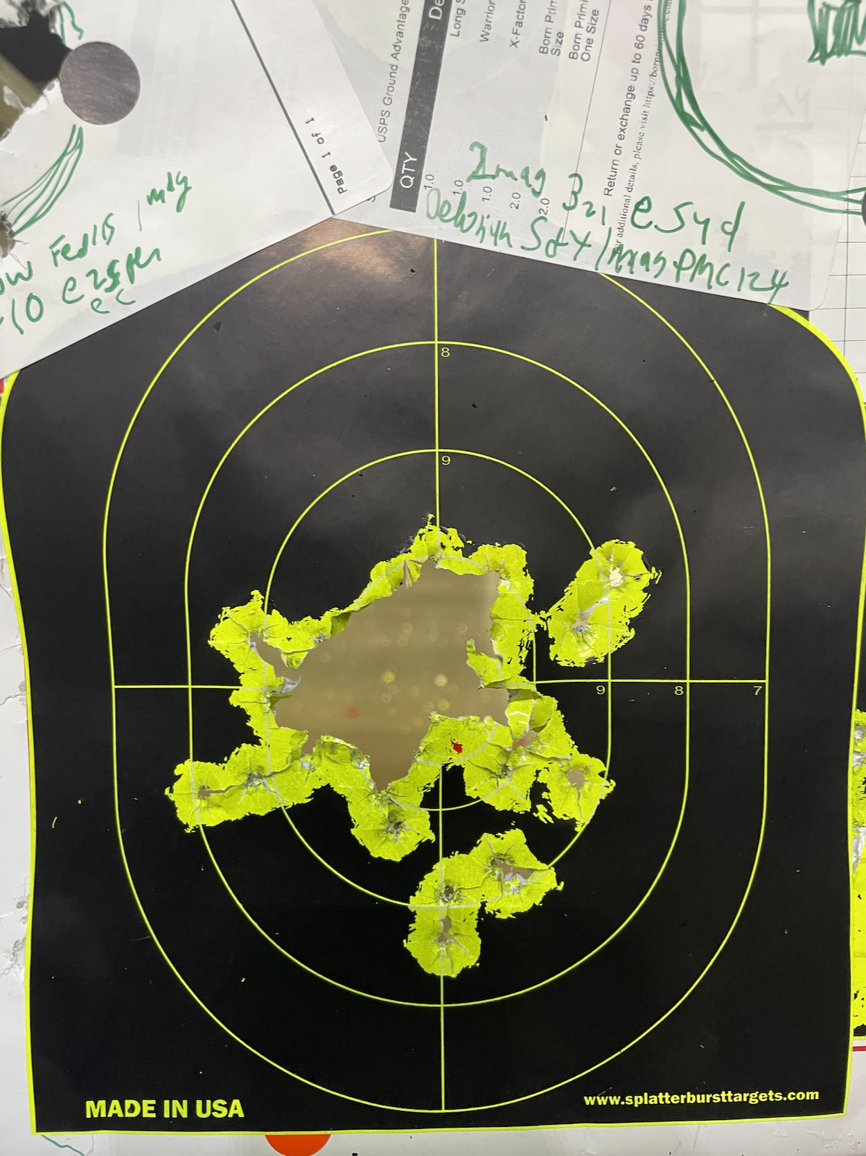
After an indoor range trip to Blackstone, I decided to give the Cleve Heavy-style Deck of Cards a try, to see if I still "had it".
- Hearts = 8-ct body builders
- Spades = Brickyard man makers (squat, clean press, lunge left, lunge right)
- Clubs = 4ct flutter kicks
- Diamonds = ruck swings
- Jokers = 1 min jog in place for the purposes of my garage workout
with Aces = 20 reps, Faces = 15 reps, Numbers = as stated.
I finished it in 1:24:15 with a 30# ruck. Not breaking any speed records, but for me, this workout is all about maintaining good form so that you don't injure anything, especially on the BYMM.
Monday, Feb 12:
Day 19 - Strength | Breath & Flow and Day 4 - Movement Yoga with Adriene. A little sore from yesterday.
Tuesday, Feb 13:
Another range trip, still maximizing the usage of the mandatory target...
Glute and pec PT v2 in 29:34, and 18A "Hanging Abs" in 19:55
WINTER WILDCAT ROGAINE
A rogaine is a style of land navigation competition where there are a bunch of flags of various point values scattered throughout an area, and the goal is to maximize the number of points that you earn within the time limit of the event.
Orienteering isn't my main hobby so I can't say this definitively because I know that I'm not aware of all the events out there, but it seems like one could argue that this is something like the premier orienteering event, at least in the US. Why do I say that? It's organized by the guy who wrote the most recommended book on navigation, especially for orienteering, Mark Lattanzi. It's a 2-day event, with 10 hours of competition each day, so it tests you physically, tests you in terms of nav skills, and tests you in terms of strategizing. He publishes the roster ahead of times, and there were a lot of big names in the adventure racing world on that list.
SB and I did the one-day 10 hour version (Search for Big Mac) in November, and it might've been one of the best days of my life (San Antonio was another). We had soooo much fun at that event, out there adventuring in the wild, working together, pushing ourselves, getting things done. We hadn't been 100% sure how we'd be in terms of recovery after Mammoth, but we did want to try Winter Wildcat.
Friday Check-in
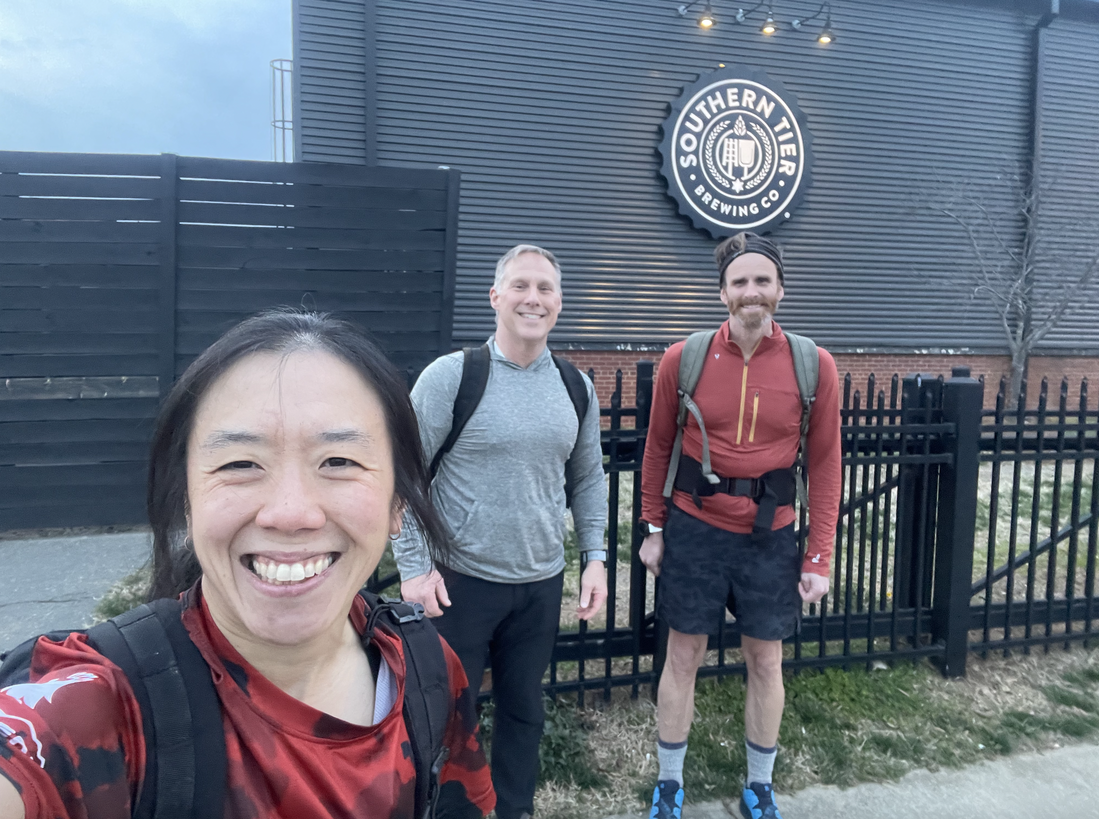
Friday, we drove up to WV to check in at Yamagata Lodge at Summit Bechtel Scout Camp. We got some nice swag and took our team pic. We wouldn't be getting maps or the tracker until the next day. As a Princetonian, I love tigers, so the swag at this race is amazing.
We saw some old friends and made some new ones over pizza and beer provided by the event. We sat with a couple from Canada, and we'd meet another guy from France as well. We were glad that we got in when we did and that we were staying at this lodge and not the other housing option in the reserve, because it started snowing! This would truly be a winter event.
Saturday Day 1
We purchased breakfast passes, so we filled up at 6:15am. We picked up trackers. Maps were distributed at 7am, which gave us an hour to do route planning before the 8am start.

There would be 4 fun twists at this year's event.
- There was a "Memory-O" where you had to relinquish your map to go on a mini-course with up to 5 flags worth 65 points each. You'd see a special map with just the memory-O points, and when you navigate to whichever one you go to first, you electronically punch and then decide which one to go for next, or if you want to head back. You want to focus on one point-to-point leg at a time, but before you step off, you want to have a general plan of what sequence you'd want to tackle them in, and which ones you want to go for.
- There's a traditional linear orienteering course with 10 CPs worth 55 points each, that you need to get all at once in and in order. We wouldn't get to see that map until we checked in at the start of the o-course, though, so you don't know how hard it will be ahead of time.
- There's a "white box" ~1x1 km blank space on the official map, where all the topo lines and features have been removed, and all you see are where the CPs are... sounds like a dead reckoning challenge to me!
- There's a "Drawing-O" that's also a white box, but the map is presented on a projector in the dining hall, and it's up to you to transcribe what you see onto your own map. It sounds easy, but detailed topo lines in a very cliffy squiggly area, where being even a little off can mess you up quite a bit. The squigglyness can actually help, I guess, because you need clear terrain association to help you know where you are, since you can't rely very much on distances and bearings if you're having to hand-draw it using a giant map onto a small map.
They were optional, but they certainly add an element of fun and uniqueness that's got to satisfy and challenge even the most seasoned competitor. We had to then decide whether our goal was to maximize points or do some activities that may not maximize points but which would be "special". For the most part, we decided to maximize points.
There were three main maps... one with a northern area in the main town of the scout camp where the points seemed to be more densely packed, one going to the east where the white box and drawing-O were located, and one going south where the most natural route seemed to go through a series or two of cliffs. At first, I was drawn towards heading East, and doing the white box followed by more points on the southern half of that map. I wanted to save the Northern Map for Day 2, since those points seemed plentiful and easier to get, and a more risk-free way to bank points when we'd be tired.
North:
East:
South:
There was also a clue sheet. Mark prides himself in not having any two clues that are the same. He's witty with some of them, too, or he shares tidbits about what it was like when he discovered the spot and what went through his mind. The clues and commentary themselves added to the fun.
After further discussion and sharing ideas, though, we decided to go South for the majority of Day 1. We had at least 1 loop going along a spur of a cliff, and there was a second cliffed spur that we could take on if we were making good time.
I felt like there was so much planning to do. I started to try to measure distances for pace counts, but it's such a big map with so many things to measure. I didn't get very far, so we'd end up figuring out a lot on the fly once the event started, but it actually turned out fine, which is good to know for the future. With squiggles, it's tough to measure that accurately anyways, so terrain association and measuring the bearings of different features is big.
We were still getting our plans and gear together when the clock hit 8am. It would be a long day, so it's not like leaving right on the minute mark makes a big deal in reality, but everyone else is rearing to go and is pumped, and you feel pressure to get out asap, too.
Everyone heads out in different directions. Snow was covering everything! We had to be careful with our steps on the icy snowy road. The lodge is at the top of the hill, and there are different ways down. We went in the direction that we wanted to go, which was East to start, before we would go south. The trails on the hill weren't mapped all that well it seemed, or it was at the very least a confusing trail network, so you watch your compass and just keep going downhill. With the vegetation and steepness, there weren't very many places to buschwhack to cut down on distance. We just followed our noses to keep going east and down.


Eventually, we saw the road that we wanted to hit, and we were able to do a nice little cut-through for the last bit. We found the trailhead that we wanted, which was another little win, and went on our way. We were looking for a river crossing, but it came a little sooner than we expected based on the map, but we took it, knowing that we wanted to be on the other side of the river. It was good that we went with that instinct, since it did end up being the right move. We saw a couple other people on the trail. One of them cut into the forest at a random spot, which surprised us. We thought he might be heading east. Then, we came across the powerline which was the backstop for the point, and it made more sense. The vegetation for our original attack plan based on the map was really thick, so we went back to where the guy had cut into the forest to find the point (103), which required a little bit of a walk into the forest. One down! It was a big 100 pointer, too!

We continued along the path and looked for the trail taking an abrupt southern turn, which is where we searched for the next point (36). I think it might've been here that I accidentally dropped my compass, but fortunately, when I went back to look for it, I found it. At least with the snow, you can see footprints of where you've been before, and I knew that I had had it leading up to the attack point. I had at least one backup compass, but it would've been sad to lose a nice thumb compass.
As we walk, I look at the map, to continue to check where we're going, figure out how best to get to where we're going next, but also see if there are other options. I saw that we could take a detour to grab a couple relatively high point flags without adding a ton of elevation or taking huge risks. SB liked the idea, so we went for it.
The roads were so quiet, since we were in a private scout camp, it was snowing, and it was just us racers here. There are some larger-than-life-sized statues in the camp that can startle you when you're not expecting to see humans out and about.
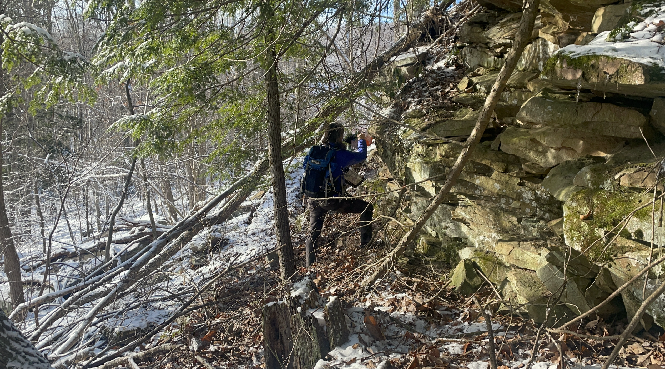
We took a road that had no footprints, so we knew we were the first ones going this way. It turns out that people had already been out this way, but they must've taken a shortcut of some sort. There is a benefit to being the first to find certain points, because Mark hid $20 bills at a few points for the first-to-finders to claim (limit one per team). Eventually, we left the road and started up a trail that took us to the point (75), which once you saw it, it seemed like it was very obvious, but also way high up in a boulder field. Good thing I like to climb!
The trail was muddy and wet in spots with the snow melting. We looked for the u-turn in the trail that marked our attack point for the next point (95). We found that, then took a shortcut back down to the road.
We took the road back to a bridge that would take us across a river to the other side (there weren't many crossings). The trail up to point 44 was slightly confusing at first, but then it started to match up. There was a big clearing where scouts could set up camp, and the point was on the far side of that.
We took another trail, keeping the cliffs to our right until a left turn, where we used a reentrant to go wards the end of a pond. It was marshy / swampy. Wet feet mean something different when it's this cold out!
We went onwards to the trail that hugged the first major cliff spur. We wanted to go for almost a kilometer and look for the first northern turn in the trail. We did find that and started going downhill. It was steep, but the reentrant was prominent. We got to the bottom and found the point (65), which was near a trail that could take us to another point, but it seemed impassible, so we went back up the way we came.
We had to start making some choices now, on which points to go towards, and how to adjust the route plan based on available time. We decided to go back up the other side of the spur to get point 105 because of its high value, to at least bank that, and then decide where to go from there. It was another one with a steep descent.

Once down there, SB had the idea of buschwhacking onwards to the next spur, instead of continuing on our original spur, to take a shortcut to point 55, and we'd still have a loop shape to grab the original planned points plus more on our way back. The tricky thing about this bushwhack is that you don't know where you've landed on the destination trail, and the direction of the trail itself didn't give as many clues this time because there were multiple spots where you went due west or south but we knew we were looking for a pretty big and flat spur. We found it, fortunately. After grabbing it, we started heading back, but then I saw that point 54 wouldn't be that much out of the way, and it seemed to be on the bottom of the cliff, so we backtracked and went around the second spur to 54. From there, we continued back up northeast on the trail, looking for the best spot to climb up the cliff. We found our spot and went for it, and found the point (35) at the top.

Finding your way down the cliff is harder than finding a route up, for sure. It's not as obvious which ways are safe, so you may do a little backtracking looking for a good way down. That's another area where the layer of snow might've actually been good, since it made for easier sliding down than roughage consisting of sticks and rock and stuff would've been.
We went up the trail and turned onto a side trail to head to point 85. We were looking for a 3m boulder, according to the clue. There were some footprints going towards one area of large boulders, which was part of the clue, although they took a roundabout way to get to the flag, which was at another, more stand-alone boulder. The flag was a bit too tall for me to get, so SB went for it. It was slippery!

We ran into another competitor while looking for this point, a solo female. We walked together for a bit, before she continued on (faster than us). The trail seemed to go much longer than expected, but we finally confirmed where we were on the map and buschwhacked uphill to get to what looked like a building. It ended up looking like an airplane landing strip or odd stand-alone parking lot or something. Very strange. The whole place feels like an end-of-the-world ghost town that suddenly got abandoned. All the structures are intact, but it's people-less. We did see our friend across the airfield, though, so we knew we were on a good track. I remember checking my thumb compass, which I kept in the same breast pocket as the punch.
We enjoyed this bit of road and civilization, before we started down a looong descent that would take us to point 84. About 2/3 of the way down, I realized that I no longer had the punch. We had scrambled down a loooong way, often on our butts, with SB going first, and me taking a slightly different path down. I called out to her to let her know. She looked very angry, haha. We really had no choice but to try to retrace our path to look for it. You only get credit for the points based on what's on the punch. The $200 or whatever replacement fee would hurt, but it was not as bad as losing all of the points we had gotten so far. We started back up. I hoped that the layer of leaf fall and dirt and sticks and snow wouldn't be so deep in my tracks that the thing would be buried somewhere along my path. I got all the way up to the top without finding it. It was a plus that our tracks were very easy to spot in the snow, because retracing the route exactly would've been harder without the snow. Now, I had to hope that it was somewhere on the road along the airfield. Fortunately, it was on the ground on the near side of the road. I didn't even have to walk to the other end of the airfield. What a miracle, it seemed! SB was probably very glad that I had found it, but I was even more glad.
We went back down the giant slope. It did seem to go faster this time. We found point 84 by a drain pipe, which wasn't too hard to find. We continued north up the quiet road, glad to still have our points. I was glad that I could mess up as badly as I did and still be forgiven. That's what it means to be a team.
Point 83 was fun. There was no flag. The punch was on top of a bouldering rock. It took climbing to get up there! There were many bouldering rocks, but the clue helped you figure out which one to climb. With the snow, I was careful with my steps. This was probably my favorite point in the whole event.
We now have choices again... we found point 83 7 hours and 21 minutes into the event, so we had about 2.5 hours left. We knew that the trek back up to the lodge would take time because it is uphill, and the switchbacks can be confusing, so we wanted to leave plenty of time for that.
We decided that we had a reasonably low-risk loop we could do around a little body of water, grabbing some points that were mostly on trail. It would eat in to some of the points that we had planned to do the next day, but at least that would free up time the next day to do other points. Maybe we wouldn't save much distance the next day, but there would be a little less searching time.
We took a switch backy trail to find point 30, and then we took a road up to point 50, which SB scrambled up to. We saw a decent number of people on this road. We then went up to point 93, where we saw some deer.
Point 43 started up the confusing switchbacks leading up to the lodge. We found it, then started taking trails that went uphill. They switched back a lot and added a bunch of distance. It felt like we were walking forever, and that the lodge had to be close the whole time, but we just kept walking. Eventually, we did hit what looked like a big cut that many others had taken to bypass the switchbacks, pointed in a northern orientation. The view was nice. We had climbed a long way!
I took a cute picture at the top before we checked in. SB made sure that I still had the punch with me afterwards.
We had to use a side entrance to check in for the day, since they didn't want muddy snow tracks through the building. Ice balls had formed early on during the day, and they grew in size as we trudged through the snow.
We covered about 18 miles and 3000 feet of gain over 8 hours and 53 minutes. In retrospect, we could've stayed out a bit longer to get another point maybe, but the point deduction consequences (50 per minute) of being late at this event are huge. Plus, we had another 10 hours of racing the next day, and we'd be tired and stiff from day 1 as it was. Overall, though, we had a pretty efficient route, I feel, and we made good use of the day.
They offered dinner again. I scarfed down burger patties and tomatoes. We now had the maps that we could do further planning on for the next day, which is different from day 1, where we went in with only planning for an hour beforehand.
Saturday Day 2
With points being our main goal, we went for the O-course first thing in the morning. We took our "usual route" down the hill and went north to the Eagle's Nest Bunkhouse, where we'd check in and get the O-course map.
There were a bunch of roads here. It took a moment to figure out what all the blue lines were, but we figured out that they were ditches for shower water to drain away from the campsites. With the sequence of points being mandatory, it made route choices a bit more straightforward because reasonable options were limited.
Point 1 by the bathrooms was easy. Point 2 took us into some trails in the forest. Fortunately, there was an unmapped trail to point 3. Point 3 did take some time to find because it ended up being on top of the cliff. I think SB enjoyed getting that one. I didn't mind her doing the legwork, haha.
Point 4 - "Northern Depression" took a little more searching than we expected, but we got it. We zig and zag across the area for points 5 then 6.
There's a path towards point 7, where we had to go back uphill to get our bearings before going back down and up again.
We run into a big group of people at point 8 including Kris Ruglowski, beeline to point 9, and then go down some really steep stuff on a seemingly short and unconnected random stretch of trail for point 10.
550 points done! We're 2 hours and 15 minutes into day 2.
Now, we go into the wild. We cross over a giant beautiful bridge that I remember coming across at Spartan races in the past. Some of this area is looking familiar now. We heard that there are some MTB trails up here, which we find. We end up following a creek and struggle to find point 53. Then, I realize that we're at the dam, we cross over, glad that there's a visible path in the snow that others have used. It's more clear in retrospect, but not so clear if you're not looking for it. Once we cross, there's more looking around until we find a steep downward slope down to the creek where the point is. 53 was surprisingly tricky!
There's definitely much less snow today. Much of it has melted. It was easier finding other peoples' paths the day before. Now, the steps and mud are all messy, and melt looks a lot like steps.
We go past camping sites up to the hill and bushwhack our way up to to a trail, which we follow towards point 62. Like we had been warned, some punches didn't survive the winter weather, so we had to just take a picture at this one. They could also tell who had been there based on the GPS trackers.
Point is 72 was a random fun military-style tent. It's cool when race directors showcase cool places in the venues that we use for events.
From here, we were truly going to go into the wild, leaving the "city" area of the camp. We passed some showers and went uphill into boulder land. We went along a trail that was going in the right direction. The terrain wasn't matching what I expected from the map, exactly, but going left onto high ground was the only way that made sense, and we found point 102 at the top, which was good.
The trail continued on around a big hill, whose northernmost point we were looking for. All was well until we were at the northern most point. We didn't see many footprints around but seemed to be at a spur. We looked all over. We used all kinds of clues from the railroad that we could see all the way down hill in Glen Jean. So many people must've already found this point, so it was odd that we didn't see footprints. It turned out that we had made some sort of parallel error and were on a trail further down the hill.
Looking back at Strava, we can see where the real trail was vs where we had been.
We had better luck finding point 61. With 71, finding the general area wasn't hard, but then the point ended up being way down the steepest looking slope ever.
We made our way back into camp town and civilization for point 82 in a reentrant. We had realized that the capital letters on the map corresponded to giant towers with those same letters written on them. They were excellent landmarks. Scouts must use them to figure out where to go, too.
It was slower going in the reentrant, even getting from one side to the other, with the thorny vines and terrain. We found the point after some searching. We returned to the road then bushwhacked up towards point 31, but there were lots of thorns up at the top, which made for slow going. We took the much easier trail back down and came across BRF BARF.
Now, it was time to get some easy points at 32. We had also realized that the weird octagons on the map corresponded to a little mini-soccer game pit that was prolific at the camp. SB knew about them from her kids' scouting experiences. They made for good landmarks, too. We got the point at 32, which was on the opposite side from what we expected, but still easy.
101 was really easy, like right on the water, no climbing onto the boulders required. 51 was a bridge and easy. For 91, we went onto some straightforward trails and looked for al the right turns and did pace counting. While I was out there, some teams popped out of nowhere from the forest. They had definitely not taken the path! We cut up to a road that took us to 80, which was in a weird area with lots of paths that took you to weird fences. I don't know what those things are used for. We were joined by another girl for a while. We made our way to point 60 together, slide down and got 42 near the water, followed by 40. From there, we split up, since we had already gotten the other points in the area the day before. We'd be heading back up to the lodge, since it was 7 hours and 6 minutes in. We took the "shortcut" straight up to the lodge this time. It was much better than the switchbacks. It's intense but super short.
We still had time, so we decided to tackle at least some of the memory-O. We had heard the times that some other teams took to complete the memory-O. 2-ish hours was considered a slow time, so we figured it could be doable. The goal is to minimize the number of times you have to go up and down the hill.
Here's what you got to memorize. We'd go for B-C-D-E-A. B was kind of on our usual way down. We just hadn't realized it was there all along. We continued all the way down to the road to get back onto a trail to attack C, which was OK. We looked for the zipline or wire. We went back down to the road via a sparingly used grass trail to get close to D, which ended up being at the top of my favorite bouldering point!
It was cool to see it from another perspective. It was a steep climb up here. There were service roads up there, though, I guess from when they built the climbing walls, and we made our way up to the main car road for the lodge, to get to A, which was pretty easy.
From there, it was a victory lap into the lodge.
We were so excited about how our use of time turned out. Completing the Memory-O hadn't been in our original plans, but it was a really unique experience, and we banked some unexpected points.
We ended up covering 21 miles and a similar amount of elevation as the day before, even though it didn't seem that way. I guess the extra trip up and down the lodge hill was about equal to the cliff climb and the extra backtrack I did for the lost punch the day before.
For dinner, we had chicken pasta this time.
There were so many women at this event crushing it, many of whom are celeberties in the nav world, which was awesome.
Surprisingly, we ended up placing in our division! With so many incredible navigators here, we were not expecting that at all.
Similar to our experiences at adventure races, us going as long as we can (while still mitigating risks) paid off big, with big points gains all the way up until the end.
It's crazy how many more points some teams (many teams) are able to get. They are MOOOOVING. We'd be close to the end of the day, and some teams would still be very far away from the lodge, but they'd make it back in time. Incredible athletes who are also great at navigation.
Once again, Mark did not disappoint! His events are so well executed. There's a reason he's the king of navigation. It was almost a surreal experience being secluded at the camp all weekend, exploring the miniature world with map and compass in the snow and melt. Fun by itself, but a million times better with a great partner.