TRAINING LEAD-UP
Monday, May 26:
30 min Yoga for Beginners & 7 min Post-Run Yoga with Adriene
Work had an HSA contribution that you could earn by getting at least 5,000 steps/day for 30/45 of the days in the challenge. When I go to the office, I end up getting in that many steps, but when I work from home, I only get that much if I do a ruck.
I ended up forcing myself to walk extra, just to make sure that I'd hit the goal. A side-benefit of doing more walks is that I'd find more nails in the neighborhood, saving car tires.
Wednesday, May 28:
18A "Lower Body Prep" in 23:37, then "Upper body Prep" in 26:06, then "My Invention" in 43:15
Thursday, May 29:
Open Yoga Flow Yoga at USNWC in the rain (a first time for me, doing yoga fully in the rain, vs in a pavilion sheltering me from the rain). My ruck club buddies came out for it anyways, and the yoga people were surprisingly resilient and weren't bothered by the rain. It was kind of fun dealing with it together. My mat got a bit slippery, but it was still fine. You do end up feeling more "one with nature" doing yoga in the rain like that.

We did our 3 miles after that, in MACV2s with a 30#R. We did move fast when we were under the power lines, just to be safe.
CY and I stuck around after to listen to music and chat.
Friday, May 30:
Finished reading "When Violence is the Answer" by Tim Larkin.... interesting book. The premise is that we can hope all we want that we don't find ourselves in situations where our lives are at risk, and we should take measures to reduce the risk of that happening in the first place. But if you do end up in that situation anyways and must defend yourself, you must fully commit, go for maximal impact, and put your body all the way through the aggressor. Although there are size and strength differences between humans, at the end of the day, even the strongest person has vulnerable spots with which they can be incapacitated, and those are the great equalizers.
Saturday, May 31:
I first became aware of the float spot when my ruck club co-leader hosted an event. I've been wanting to bring my parents there, since it seems like a CLT staple. I bought floaties last year, but we never got to use them. I finally got to bring out my dad.
He used a raft with a solid bottom so that he could stay more dry, while I used a tube with a mesh bottom. The raft came with little paddles, which were super helpful when we had to get onto the main river in the beginning, and avoid getting pulled into a side-channel with the current. Even with the paddles, it was hard, and we barely made it.
During the float, we often paddled, too, since I think my dad eventually got tired of just floating for that long and wanted it to be done after a while. We saw a cool bird and lots of turtles. It was nice drinking hop-flavored water and chatting.
SOUTH FORK SAMPLER
This year, they didn't have a 4 hour and an 8 hour version (plus a corporate shorter version) of the event. Instead, there was only a 5-hour competitive event, plus a family-friendly shorter edition. That makes sense, since numbers weren't huge.
SB couldn't make it this year, but a rucking buddy was able to take her spot on the team.
BR & I met up in the morning to get a good parking spot, secure our rental paddle gear, check in, and align on our race strategy. This was our first time teaming up, so it was good to have a little bit of time to do some rough planning (as much as you can do without the map yet). I was ok with just having fun at the race, but she wanted to perform well, which was awesome, so that was going to be our goal.
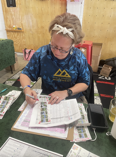
The 9am race started off this year like it did last year, with a bottle cap toss. For each lap that you run around town square, you got a bottle cap. Unlike last year, I had great success this year and got it on my first shot. BR never even had to make an attempt! I learned from my left and right deviations last time. Once you made your shot, you got maps and the passport where you'd punch in to prove that you made it to each CP.
The rules were that for the first 30 minutes, you could only be on foot, which puts a big twist on race strategy. You can only do so much in 30 minutes, but you also want to maximize what you accomplish in that time. But you also want to be back at HQ by the end of it, ideally, so that you can set off on more efficient modes of transportation.
I thought through what we could reasonably accomplish in 30 minutes. I wasn't going to go South up the hill, since that point was far away and uphill. It didn't make sense to go into the town for the closer town points, since we'd end up going that direction to get further into town anyways for other points later. The Rocky Branch points were also far, and we'd pass by "Riverside" when we were going to Rocky Branch. That left going North.
We started off by grabbing "Pier," which was quick and easy.
We started to move towards "Riverlink", but judging by our pace, it didn't seem likely that we'd go there and back in time, not by a long shot, so we turned around and decided just to use the time to get ready to bike. It actually ended up working out well. There was time to use the restroom, switch shoes, put on helmets, and everything. I didn't end up using a map board this year, because I hadn't set up my replacement CoPilot yet. Fortunately, the map for this race is simple enough that you can be ok without it, especially if you know the area. When everyone was released, we were ready!
We rode back onto Goat Island to get "Riverlink", followed by "Path," which was marked as "5hr only". Having both races' points plotted on the same map meant that you had to pay extra attention to which ones you actually needed to grab.
In Rocky Branch Park, we got "Platform," which is a MTB feature that I don't think existed last year. "Right Field" was taken out of play because recent rains meant that the MTB trails were closed, but the RD replaced that with a selfie that you had to take at the Belmont side of the park. BR likes biking, so I'm glad she got to experience some nice green-level biking at Rocky Branch.
On our way back, we grabbed "Riverside" and then went into town. We had prioritized getting the town points next, since there were more of them. "CB Huss" was a little tricky. We found the concrete hut, but it took us a couple minutes to find the cone. It was really right in front of our noses.
Finding a good crossing to get over to "New Town" can also be a bit tricky, but like last year, we managed to hit just the right part of town to find it when we did cross.
Our last bike point was "Share," which was up the hill. The hill felt a little easier than I remembered it being in the past.
We screamed back downhill, making our way to the kayak launch just in time for this year's special twist - the Donut Dangle. Between 11am and noon, they'd be dangling donuts off the bridge into Goat Island. If your team grabbed one from water level, you'd get a bonus point.
Just as we were about to try to grab it, they yanked up the basket holding the donuts, but we swung back around and grabbed them on our second go-around.
"Pond" had a log across the water that could get you a little stuck, but we used our oars to push against the ground and get through.
"Island" was in the water this year. The channel on the side of the island closest to the mainland was where the point ended up being. The map doesn't have high resolution, so you can't tell exactly where on the island the point is supposed to be. In fact, the dot representing the point covers the island completely. We saw teams coming from the small channel side, so that's where we went in, but we quickly found that the water was shallow. With 2 of us in the boat, we were lower in the water, so early on, we could tell this was going to be slow going. We decided to dock the kayak and search on foot. It was a ways away, but it was still faster going on foot vs trying to trudge through by boat.
Kayaking was tough, because somehow, the kayak kept listing to one side. It was like we had a skewed rudder on the boat or something. Our last point was about the same distance as Island from HQ, but in the other direction. I only had to endure the listing kayak by compensating heavily with strong strokes on one side for a bit longer! The next point was also cute.
As we got back and pulled the kayak onto land, one of the top athletes (running solo for this race) warned us that we may want to keep the boat nearby, since bonus points were in play. We checked in at HQ, showed that we had cleared and got our first bonus point. We had to go pretty much double the distance of the point that we had just gotten, and take a selfie of ourselves touching a specific bridge. My shoulders were sad, but we weren't going to give up any points!
We got that point and were glad that the bonuses would alternate water/land/water/land. The next point was back up the hill. I'd take the hill over more paddling!
The next point was back on the water, but not too far away. It was a closer bridge. I considered it, but between wanting to be conservative about not being late and DNFing and knowing how much kayaking straight has been a challenge, we decided to call it there, come what may.
We ended up covering about 21 miles in 4:42:36. I estimate it was 12 miles of biking, 8 miles of paddling, and 1 mile of running.
To our delight, we ended up doing quite well, tied for third overall!
Another fun event. BR was a great teammate. Seriously, this is such a good one for anyone wanting to get into adventure racing!


No comments:
Post a Comment